Our publisher Solstice Publishing is helping us with our Subscribe promotion over at JBOTV on YouTube. We are offering 2 Free Ebooks HOOKED and Aftermath for free simply by subscribing to JBOTV. All you have to do is go to our about section and the link is right there at the bottom. It is a secure drop box link and the books will download immediately.
This promotion will end once the subscriber number hits 1000, and as of this blog the count was around 760.
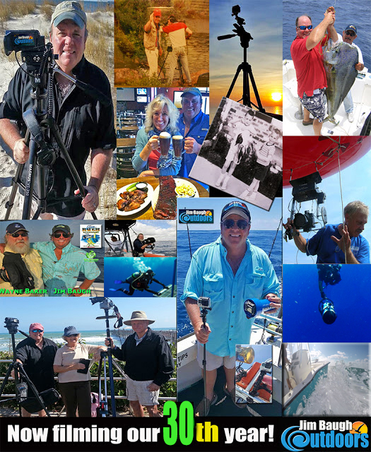
For the past two years Jim Baugh Outdoors has diligently been building our channel with now 30 years of archives in addition to our new shows. Also we have a special recipe and photography playlist. JBOTV is updated several times weekly and is the only place that we have made all our 30 year content available and it's free.
Please feel free to leave comments and suggestions we always like to hear what our viewers like to see the most.
So subscribe today and enjoy the books, they are Amazon best sellers, link below for reviews etc.
JBOTV Has over 45 years production experience in producing
music, television and all aspects of field and post production. Now JBOTV has
started a playlist of useful tutorials and product reviews that will provide
insider tips for photography gear and editing. Please feel free to leave
questions and comments and share your outdoor photographic experience with us.
Enjoy!
JBOTV Uses 5 cameras in the field filming and one of the camera rigs is somewhat disposable. We will always loose cameras on wrecks from time to time. On our recent offshore sea bass shoot we lost our Scinex HD camera in 160+ feet of water, so off to find another replacement.
We came across the Auky 4K and it really is a great little package.
If you need an action cam in the $50 to $100 buck price point, check our review out.
Subscribe update promotion: Right now we are offering FREE both Ebooks Hooked and Aftermath to all new subscribers to JBOTV. Simply go to our about section on our channel and the secure dropbox link is right there. Enjoy and thank you! JB
Jim Baugh Outdoors filmed this exciting episode during February 2018 on board the Rudee Angler, Virginia Beach Virginia. This was a special sea bass season and was filmed on the last day of the season. JBOTV used several underwater cameras and unfortunately lost one of them deep droppin on a wreck in 160+ feet of water. Other production tools of note is a custom made 12 foot camera boom that we used offshore in order to get a lot of the field footage. Sea bass fishing out of the Mid Atlantic is great and highly recommend taking your friends and family out on such an adventure. It is a trip you will remember for a lifetime. For more information contact the Virginia Beach Fishing Center.
Jim Baugh Outdoors TV travels to the Miami International Boat Show 2018 and checked out the NEW Tideline 365 Catamaran! This year was an awesome show and it for sure is a great time to be in boating. For more info on the new 365 Offshore just contact Tideline Boats at tidelineboats.com
View Film Below on JBOTV
Special shout of thanks for all that made this feature possible: George and Michael at Tideline Boats, Sasha at Vine Communications, Wayne Baker, Mermaid Bay Media, MBM Grading, and Steel Drum artist Doug Walker (heard during Key Largo Dive segment) Thanks again to all.
Ok Sports fans! Better reserve your spot quick because this
sucker is gonna sell out! It is the last trip out for the Feb season and JBOTV
is gonna film it! Yup, a return trip offshore for deep sea bass fishing. Over
the past 30 years, the shows we have filmed on these wrecks have been among our
most popular shows and we love to catch and cook up delicious sea bass. Join Us!! Be on the show! It is one heck of an
adventure. At the dock at 2am, fish all day and return back to Rudee. JBOTV
will also have deep water underwater cameras we will be using to film these
wrecks in approx. 150 to 200 feet deep. We can’t wait and neither should you!
Book your spot today, the first two Saturdays sold out and this last day will defiantly
fill up. Call the Fishing Center at 757
491 8000. Look forward to pullin up some sea bass with yall Great fun!
Kicking off 2018 Jim Baugh Outdoors is taking on a rather
large offshore deep sea project that includes revealing some fascinating untold
WW2 stories. Filming will take place over a 9 month period of time. We also
will be in search of one of the largest undiscovered WW2 wrecks off the mid
Atlantic. Not only will we be diving on these wrecks, but filming some
incredible fishing footage. This project will take most of 2018 to produce/
film and will be featured as a part of our 2019 and 2020 series. As we go
through the production process we will be posting short films on our JBOTV
channel.
This type of project takes an enormous amount of research
and already in looking at many wreck/dive site numbers we have found the name
of one of the most famous “secret” wrecks, at least as far as JBOTV goes.
Here is what happened.
Researching dive wrecks, hang numbers and getting a map
going of our locations for this story, I called Captain Peter Bregant from
Virginia Beach and checked with him to see if he had any wreck numbers in the
areas we would be filming. In our discussion, he mentioned the Billy Mitchell
wrecks. I had not heard of them but when we discussed there general location, I
was floored. This seemed to be the exact location where we filmed one of our
most popular shows; sea bass fishing for giant sea bass with Captain Jim
Brincefield.
WOW. Back over 15 years ago when we filmed these shows, Captain
Jim was doing a good buiz chartering these big offshore excursions for sea
bass, his reputation became quite legendary and he was a great guy! While we
were filming he mentioned that this wreck we were fishing was a “secret” wreck
and only a hand full of people knew about it. Well, that is what he told me at
the time.
So, while filming for the show I “accidently” filmed his
chart plotter and was able to see the numbers. I never posted them or ever
shared them because he said it was a “secret” find. What I did not know until now
was that I along with many people had already published the name of this wreck
with the lat lon numbers. The wreck and the numbers were very public, but since
it was a pretty good distance offshore it just was not fished that much.
I was very excited to
check the GPS numbers of Billy Mitchells wreck site which is a pre WW2 site.
Since our features we were going to be producing were from WW2, I knew these
ships would not be a part of the story. However just the thought of possibly
finally knowing the name of the exact spot from our sea bass fishing location
was a thrill to say the least. Even to this day it is one of our most popular
downloads.
I loaded up all 10 wreck site numbers from Billy Mitchells
wreck site and to my surprise the numbers I had gotten off the boat while
filming 15 years earlier did not match. The numbers I had were south of the
Billy Mitchell wreck site. Dam!
Well I figured old Captain Jim was telling the truth, it was
a secret site. Looking at the chart I really had wished the numbers were there.
Mostly for nostalgia sake, the fact is any of the Billy Mitchell wreck sites
are probably fantastic places to catch sea bass. The simple point was I wanted
to know the wreck name of a show we filmed that meant a lot to me, and still
does to this day.
I had looked at the chart so much the numbers of this “secret”
wreck were in my head.
Before shutting down the charts I thought it would be a good
idea to repost the JBOTV GPS page which has not been posted for years. The
numbers are a gathering from many sources and when I have time I will go
through post the numbers on a chart and see if they are in the general area of
where they should be. The ones that are not, I delete. This list is always a
slow work in progress and a lot of the numbers are posted elsewhere. This list
is a combination of our dead on numbers, and numbers from non-verified sources.
So always before you head out, do your homework.
Just before heading down to make dinner I typed in a couple
of numbers for grins and one lat lon number seemed oddly familiar. Once entered
and a click of the enter button.
BOOM!
The new GPS marker on the chart is sitting just south of the
Billy Mitchell wrecks!
WAIT A SECOND! LET ME INPUT AND CHECK MY ORIGINAL NUMBERS
FROM 15 YEARS AGO!
I’ll be damned. They were almost the identical numbers. And
when I entered in my original numbers into the chart and hit enter, the marker was
on top of the pervious marker!
I found it! And by accident, just simply checking some old
numbers I had already posted. I just never knew that the wreck we had listed was
the “secret” wreck.
Before I wrote this I spent a lot of time checking and yes,
this wreck is posted in many places all over the internet. The history of the
wreck is about as interesting as it is a fantastic fishing hole.
The name of the wreck is… (be sure to read our update!)
The Benjamin A Van Brunt
This was not the Brunt but a 4 mast schooner of the time. The Brunt
was approx. 40 feet longer than this ship.
The BA Van Brunt was a 4 masted schooner that was 185 feet
with a 42 foot beam. She was from Manasquan NJ and was approx. 1,200 gross
tons. The Brunts history was quite sorted before she became the Atlantics best
sea bass spot.
The BA Brunt was sunk in a collision with the USS Milwaukee on
Sept 21, 1925 and now rest on the ocean floor.
The BA Brunt was no stranger to collisions. In 1907 the
Brunt collided with the schooner Alicia B Crosby and before that in 1892 the
Brunt collided with the steamer ship Providence!
In 1900 the Brunt was found running on an expired
certificate.
The ship the Milwaukee that sent the Brunt to its bottom
fate, had also had its own history of previous collisions. Seems like back then
everybody was running into everybody!
To find out more about the Billy Mitchell Wrecks click below
UPDATE: Once we posted this article online we heard from several
captains who notified us that the wreck was NOT the Van Brunt. This being true
would mean that the old published name for this wreck number would be
inaccurate. Turns out this does seem to be the case.
The correct name of the wreck is.. the USS Washington! The
numbers are still correct, but the name was wrong. The spot where we filmed the
show was the Washington. The Washington wreck site has also previously been
published to the public. This also makes a bit more sense because I clearly remember the HUGE relief of the bottom. Seemed to me possibly larger than a schooner would be.
Where ever the Van Brunt is I have no idea, but we do know
her last collision was with the bottom of the ocean, may she rest in peace.
Captain Jim was one of our favorite captains to be featured
on our show and we were extremely saddened by his passing in a horrible
accident. RIP Captain Jim you are truly missed.
Below is the GPS scratch pad list that we previously posted
on JBOTV first web site over 20 years ago. This data came from several published magazines and most of which was the Chesapeake Angler. The list has been partially updated.
ALWAYS check your own numbers with a second source before heading out. A good place to start is your local tackle stores, guides, captains, etc.
There are a lot of numbers on the web now so
it is easier than ever to cross reference your numbers.
If you use a coordinate on this list and it is incorrect or you cant find the wreck, please feel free to blame JBOTV, it will go over better with your crew and charter. After all a good captain may be misunderstood, misinformed, misguided, but...
NEVER WRONG!
NOTE: All the GPS numbers below are numbered for reference. We respectfully ask if you have updated info or would like us to include your numbers, additions to ours, etc (for example another number on the same wreck, different position that may be helpful) just let us know. You can email us at
Please also note that just because you cant find the wreck it does not mean it is not there. Many wrecks get washed over with sand, moved, buried, or broken apart through the years. Then there is also the possibility that the numbers or name of the wreck is incorrect, this we also have experienced many times, even in this post!
Some wrecks will be very dominant with a high relief of structure, others may just be rubble in the sand. That is why it is always good to get as much local info as you can, charter a dive boat, or good bottom fishing charter and just gather as much information as possible.
For us, wreck hunting is about as much fun as finding one and fishing it!
Should you email us with updated info will respond asap, please remember we have a heavy production schedule and we will update these numbers as time allows.
Thank you, tight lines!
Jim Baugh
Jim Baugh Outdoors TV
Route #1 26 mile hill
1) N36 59.754 W76 18.895 Hampton
2) N37 11.857 W75 16.446 Hump towards hill
3) N37 15.621 W75 11.125 26 mile hill
4) N37 01.106 W75 26.093 Return troll westerly
5) N36 59.754 W76 18.895 Return to home base waypoint
Route #2 44014 Data (weather) Bouy North East of the Cigar
** First Waypoint is around the Cape Henry area
6) N36 58.632 W75 59.734 Cape Henry
7) N36 37.041 W74 57.838 Hump before the bouy (7.28 miles)
8) N36 34.862 W74 50.085 Weather Bouy 44012
9) N36 58.632 W75 59.734 Cape Henry
Total roundtrip distance is 140 miles
Route #3 Hot Dog Area & Humps
**This route STARTS at the bottom south west corner of the
Hot Dog. Enter your own departure waypoint to figure total trip distance.
10) N36 43.440 W75 18.676 Bottom of the Dog
11) N36 42.538 W75 19.282 Hump under the Dog
12) N36 42.261 W75 21.316 Next hump south
13) N36 41.046 W75 23.437 Next hump westerly
14) N36 40.248 W75 25.558 Next hump South Westerly
15) N36 42.018 W75 25.168 Next hump North East
16) N36 47.162 W75 30.713 Crossing over the bone heading back
towards the Bay.
Total trolling distance is 19 miles while offshore. You will
need to add trip distance out and back.
Redbirds (Numbers from JBOTV when rail cars deployed in 2000)
Below are various numbers collected from magazines, the web, and other sources. Certainly all numbers are not verified, however good reference to use with other collaborative data.
#158. Wreckage 36 54.315 N 75 43.411 W
#159. Landing Craft 36 54.235 N 75 43.405 W
#160. Barge 36 54.238 N 75 43.351 W
#161. Landing Craft 36 54.170 N 75 43.756 W
#162. Barge 36 54.186 N 75 43.460 W
#163. Barge 36 54.146 N 75 43.425 W
#164. Wreckage 36 54.196 N 75 43.415 W
#165. Barge 36 54.191 N 75 43.400 W
#166. Wreckage 36 54.206 N 75 43.391 W
#177. Wreckage 36 54.193 N 75 43.320 W
#178. Landing Craft 36 54.145 N 75 43.542 W
#179. Wreckage 36 54.164 N 75 43.455 W
#180. Landing Craft 36 54.139 N 75 43.448 W
#181. Landing Craft 36 54.168 N 75 43.404 W
#182. Landing Craft 36 54.147 N 75 43.328 W
#183. Wreckage 36 54.158 N 75 43.285 W
#184. Landing Craft 36 54.157 N 75 43.269 W
#185. Concrete Blocks 36 54.153 N 75 43.203 W
#186. Landing Craft 36 54.092 N 75 43.751 W
#187. Landing Craft 36 54.094 N 75 43.556 W
#188. Landing Craft 36 54.077 N 75 43.546 W
#189. Barge 36 54.104 N 75 43.454 W
#190. Landing Craft 36 54.113 N 75 43.399 W
#200. Barge 36 54.092 N 75 43.390 W
#201. Landing Craft 36 54.111 N 75 43.368 W
#202. Large Wreckage 36 54.107 N 75 43.358 W
#203. Concrete Blocks 36 54.085 N 75 43.355 W
#204. Big Barge 36 54.126 N 75 43.285 W
#205. Landing Craft 36 54.067 N 75 43.222 W
#206. Landing Craft 36 54.023 N 75 43.636 W
#207. Barge 36 54.093 N 75 43.363 W
#208. Wreckage 36 54.021 N 75 43.283 W
#209. Concrete Blocks 36 54.025 N 75 43.237 W
#210. Wreckage 36 54.044 N 75 43.268 W
#211. Concrete Blocks 36 54.044 N 75 43.150 W
#212. Wreckage 36 54.043 N 75 43.082 W
#213. Landing Craft 36 53.964 N 75 43.625 W
#214. Landing Craft 36 53.964 N 75 43.573 W
#215. Landing Craft 36 53.941 N 75 43.476 W
#216. Wreckage 36 53.952 N 75 43.419 W
#217. Landing Craft 36 53.969 N 75 43.309 W
#218. Wreckage 36 53.975 N 75 43.308 W
#219. Barge 36 53.994 N 75 43.297 W
#220. Landing Craft 36 54.002 N 75 43.288 W
#221. Barge 36 54.001 N 75 43.293 W
#222. Wreckage 36 54.970 N 75 43.297 W
#222. Tug 36 54.960 N 75 43.359 W
#223. Barge 36 54.038 N 75 43.271 W
#224. Landing Craft 36 54.948 N 75 43.279 W
#225. Landing Craft 36 54.979 N 75 43.258 W
#226. Barge 36 54.000 N 75 43.253 W
#227. Barge 36 54.978 N 75 43.234 W
#228. Landing Craft 36 54.914 N 75 43.639 W
#229. Landing Craft 36 54.918 N 75 43.579 W
#230. Barge 36 54.926 N 75 43.538 W
#231. Landing Craft 36 54.924 N 75 43.511 W
#232. Wreckage 36 54.876 N 75 43.738 W
#233. Landing Craft 36 54.894 N 75 43.606 W
#234. Landing Craft 36 54.901 N 75 43.549 W
#235. Landing Craft 36 54.884 N 75 43.552 W
#236. Landing Craft 36 54.895 N 75 43.485 W
#237. Barge 36 54.895 N 75 43.472 W
#238. Blocks 36 54.888 N 75 43.433 W
#239. Wreckage 36 54.884 N 75 43.427 W
#240. Landing Craft 36 54.884 N 75 43.393 W
#241. Wreckage 36 54.853 N 75 43.530 W
#242. Wreckage 36 54.836 N 75 43.450 W
#243. Wreckage 36 54.838 N 75 43.433 W
#244. Wreckage 36 54.863 N 75 43.407 W
#245. Landing Craft 36 54.861 N 75 43.340 W
#246. Landing Craft 36 54.814 N 75 43.662 W
#247. Landing Craft 36 54.804 N 75 43.581 W
#248. Wreckage 36 54.820 N 75 43.483 W
#249. Wreckage 36 54.790 N 75 43.472 W
#250. Landing Craft 36 54.831 N 75 43.455 W
#251. Blocks 36 54.800 N 75 43.444 W
#252. Blocks 36 54.796 N 75 43.327 W
#253. Wreckage 36 54.830 N 75 43.301 W
#254. Barge 36 54.080 N 75 43.272 W